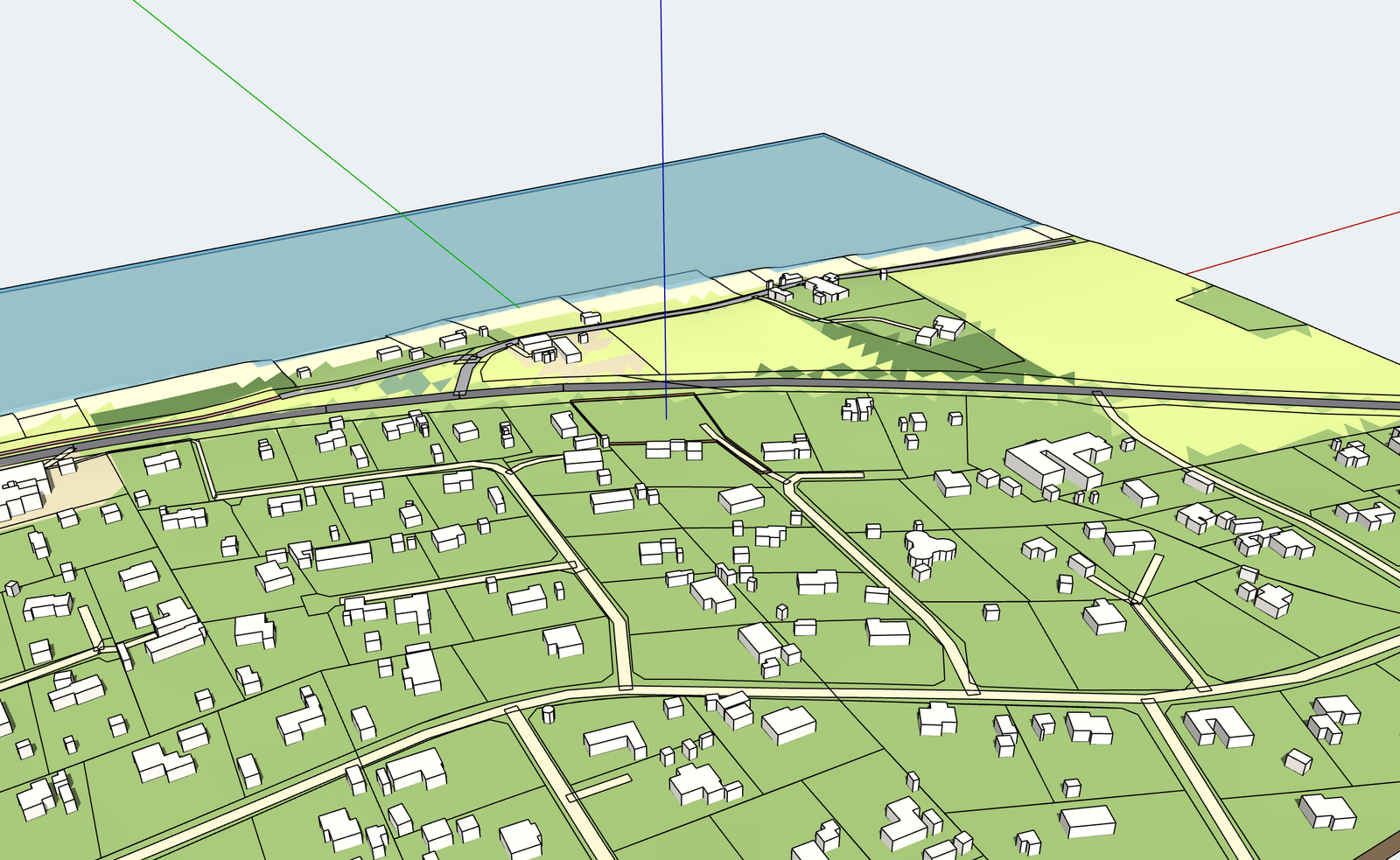
I’m starting a concept for a summer-house plot. The first job on any site is a base model: ground levels, roads, neighbours and boundaries.
This time I built it with Claude working directly inside SketchUp. Working from my research folder, it pulled together several open datasets: the Danish address register (DAWA) for surveyed ground heights and parcel boundaries, OpenStreetMap for roads, buildings and the coastline, and a 25 m European elevation model for the terrain in between. It then wrote the geometry into SketchUp as a 600 by 600 m model, with separate tags for terrain, water, roads, neighbouring buildings, cadastre and the site boundary, plus three saved views.
The most useful part was the checking. The elevation model read about 1.3 m high against the surveyed address points, so the terrain was corrected to match them. The coastline data put the Kattegat shore roughly 120 m north of the plot, a good deal closer than the 0.4 to 0.5 km in my earlier desk research.
The model came together in under 30 minutes, with every source and assumption written down alongside it. It is still an indicative model (the levels will require a proper survey in due course), but it is a solid base to design against.
Next comes massing. The research points towards testing two routes on this model: reworking the existing house, or replacing it with a compact new volume.
If you’re working on early-stage site studies like this and would like to compare notes, please get in touch.